1

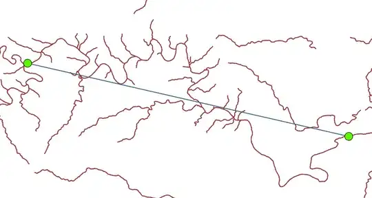
I am fairly new to ArcGIS Pro, and I want to create a line that follows the curvature of a river shapefile and lays between two points. Attached below is a screenshot. I tried using the "Points to Line" tool, but that just gave me a straight line between the two points. Instead, I would like the line to follow along the river from the first point to the second point. I am trying to highlight a sub-reach in a river reach study.

Points and river shapefile.

Result of "Points to Line."

Erica
  • 2,399
  • 5
  • 26
  • 34
Nate
  • 19
  • 1
  • 2

1 Answers1

0

There's a couple possible ways...

Manually:

  1. Start by making a working copy of your river layer, since we'll be messing around with it.

  2. Split the river polyline at the points you're interested in, using the Split Line At Point tool.

  3. Then, delete the estuaries and so on that are not part of the direct line from A to B.

  4. Finally, merge the remaining line segments back together.

If you have a Network Analyst license, then you can build a network using the rivers and then do a point-to-point route finding.

Erica
  • 2,399
  • 5
  • 26
  • 34