I have a PostgreSQL / PostGIS database with polygons (which represent rooms of a floor in a building) in it. When I try plotting them using matplotlib (directly from database) or mapshaper (from a shapefile containing the polygons), the output looks normal. However, when OpenLayers (5.3.0) displays them - they're a bit skewed and elongated on the y-axis. I'm using ol-layerswitcher alongside OL.
Plotting the polygons in matplotlib: 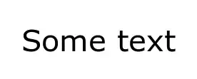
Plotting the polygons in OpenLayers: 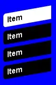
I've tried applying a "dirty fix" by scaling down on the y-axis in hopes of undoing the skewing effect, however scaling doesn't work and it actually somehow worsens the output (picture below).
This is map initialisation:
var mapView = new ol.View({
    center: ol.proj.fromLonLat([14.426102028368888, 45.3375708862643]),
    zoom: 20,
    minZoom: 0
});
var levelsGroup = new ol.layer.Group({
    'title': 'Katovi',
    layers: []
});
levelsGroup.setZIndex(1);
var worldMap = new ol.layer.Tile({
    source: new ol.source.OSM(),
    zIndex: -1,
    projection: 'EPSG:3857'
});
var map = new ol.Map({
    layers: [
        levelsGroup,
        worldMap, // world map, for georeferencing
    ],
    target: 'map',
    view: mapView,
});
This is how OL is getting and parsing the data:
// ... get data from django with ajax
var singleLevel = new ol.layer.Group({
// create a layer group for the floor
    floor_num: JSON.parse(data[0])['features'][0]['properties']['level'],
    type: 'base',
    combine: true,
    visible: false,
    layers: []
});

for(var j = 0; j < data.length; j++) {
    // Parsing the JSON file from backend
    var parsedPolyType = JSON.parse(data[j]);
    var polyName = parsedPolyType['features'][0]["properties"]['name'];

    // This will create a new vector layer with a source containing a single poly type (room or wall etc) for i-th floor
    var singleType = new ol.layer.Vector({
        source: new ol.source.Vector({
            features: (new ol.format.GeoJSON()).readFeatures(parsedPolyType, { featureProjection: 'EPSG:3857' }),
        })
    });

    for (var k = 0; k < singleType.getSource().getFeatures().length; k++) {
        singlePoly = singleType.getSource().getFeatures()[k];

        // [14.4253, 45.3371] are the coordinates of the bottom left point of the floor plan's bounding box
        singlePoly.getGeometry().scale(1, 0.95, ol.proj.transform([14.4253, 45.3371], 'EPSG:4326', 'EPSG:3857'));

       // style the geometry according to its type,
       // if it's a polygon this will give it a black outline with white filling
        createStyle(singlePoly, singlePoly.getProperties().type, singlePoly.getProperties().name);
    }

    singleLevel.getLayers().push(singleType);
}

var last_item = levelsGroup.getLayers().push(singleLevel) - 1;
levelGroups.push(singleLevel);

// switch to the new layer level and make it visible
switch_layer(levelsGroup, last_item);
This is the output I'm getting when trying to scale (1 on x-axis, 0.95 on y-axis):

In addition to being a bit scattered, some of the polygons lose their styling (the blue styling is OL default). The unstyled polygons are not scaled at all.
So, I have three questions:
1) Why are the polygons skewed in OpenLayers?
2) What am I doing wrong when trying to scale them down?
3) Is there a better way to fix this other this dirty fix?
EDIT:
Forgot to mention, the polygons in the database are in EPSG:4326.
Here is the code used for styling:
styles = {};
styles['room'] = {
    strokeColor: 'rgb(0, 0, 0)',
    strokeWidth: 3,
    fillColor: 'rgba(255, 255, 255, 1)'
}
styles['room'] = jQuery.extend({}, defaultStyle, styles['room']);
styles['wall'] = {
    strokeColor: 'rgb(0, 0, 0)',
    strokeWidth: 1,
    fillColor: 'rgba(200, 200, 200, 1)'
}
styles['wall'] = jQuery.extend({}, defaultStyle, styles['wall']);

function createStyle(singlePoly, styleName, polyName) {
    if(styleName in styles) {
        text = styleName == 'room' ? polyName : '';
        singlePoly.setStyle(styleWrapper(styleName, text));
    }
}

function styleWrapper(styleName, text) {
    var curr_style = styles[styleName];

    //returns a function which is used as a style for a polygon
    return function() {
        zoom = map.getView().getZoom();

        return [
            new ol.style.Style({
                stroke: new ol.style.Stroke({
                    color: curr_style.strokeColor,
                    width: curr_style.strokeWidth
                }),
                fill: new ol.style.Fill({
                    color: curr_style.fillColor
                }),
                text: new ol.style.Text({
                    scale: curr_style.textScale,
                    text: zoom >= curr_style.minZoom ? text : ''
                })
            })
        ];
    }
}
EDIT 2: