I try to understand how anchor boxes coordinate generated from feature map, and i have some questions about this process.
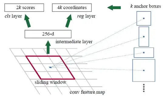
1-) From above image, feature map size is N x M x C and sliding windows is chosen as 3x3. What is the mission of this 3x3 window? I think, it is used to down size from NxMxC to NxMx1? Am i right? if noti what is the mission of this window?
2-) To obtain anchor boxes coordinate on RGB input image from feature map, how 3x3 windows affect this coordinate?
Thanks in advance.