0

I have a shapefile with a transverse mercator projection. It also has false northings/eastings values associated with it in ArcGIS. I am trying to map the polygons onto a Europe map, but they are not showing up on it. When I use worldmap world the polygons show up in Africa, even though they are supposed to be in Ireland.

How can I plot my polygons in the right place? They have latitudes and longitudes associated with them, so I think it has to be the projection.

S = shaperead(polygons.shp','UseGeoCoords', true)

h = axesm('tranmerc','FalseEasting',60000,'FalseNorthing',750000,'Grid','on','Frame','on', 'MlabelParallel',0,'PlabelMeridian',0)

When I try to plot the latitudes and longitudes, they end up in Africa:

h = plot([S.Lat],[S.Lon], 'k:');
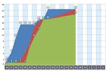
polygons in Africa

Or when I try and use geoshow they fill up the map completely with a color:

geoshow(S,'FaceColor',[1 1 .5],'EdgeColor',[.6 .6 .6]);
color fill map

sco1
  • 12,154
  • 5
  • 26
  • 48
new2matlab
  • 37
  • 8
  • What are the coordinates... – sco1 Jul 05 '16 at 15:49
  • A better place for GIS questions is probably [gis.se]. – Dev-iL Jul 05 '16 at 15:51
  • Even if your shapefile is projected as a transverse mercator it don't meant that your coordinates are correct ! – obchardon Jul 05 '16 at 15:54
  • @excaza: Which coordinates are you referring to? The latitude and longitudes? there are over a thousand per polygon. Should I post them? – new2matlab Jul 05 '16 at 21:04
  • @Dev-iL. I disagree I'm afraid. I have no problems doing this in GIS. My issue is that i need to automate it within a matlab script. – new2matlab Jul 05 '16 at 21:05
  • @obchardon. I was assuming that my coordinates were correct, as they map out fine within ArcGIS software. Although, I will check as you suggest. – new2matlab Jul 05 '16 at 21:06
  • I pointed you to that site because the visitors there have a more specialized knowledge of this field, and may have encountered similar problems and/or solutions. Posting a question in one site or another doesn't guarantee an answer, I just wanted you to be aware of the possibility. – Dev-iL Jul 05 '16 at 21:08
  • I suggest you provide a small sample of them so others can potentially reproduce your issue rather than throwing darts at the "what could be wrong" dartboard. See: [mcve]. – sco1 Jul 05 '16 at 21:10
  • @new2matlab please do not make edits that actively harm the readability of your post... – sco1 Jul 06 '16 at 01:47
  • Thanks. @Excaza I am including a link to one of the small polygons I am trying to plot: http://www.filedropper.com/stackoverfloweg – new2matlab Jul 06 '16 at 13:05
  • @Dev-il: Point taken. I might throw this question up on a GIS site too. – new2matlab Jul 06 '16 at 13:08
  • @new2matlab A word of caution - the act of "cross-posting" (i.e. posting the same question on different .se sites) is discouraged. If you see you can't get an answer here, either flag your own question for mod attention and ask for migration to another site; or delete it and re-ask elsewhere. – Dev-iL Jul 06 '16 at 14:09

0 Answers0