2

I'm trying to estimate a position based on signal strength received from 4 Wi-Fi Access Points. I measure the signal strength from 4 access points located in each corner of a square room with 100 square meters (10x10). I recorded the signal strengths in a known position (x, y) = (9.5, 1.5) using an Android phone. Now I want to check how accurate can a multilateration method be under the circumstances. Using MATLAB, I applied a formula to calculate distance using the signal strength. The following MATLAB function shows the application of the formula:

    function [ d_vect ] = distance( RSS )
    % Calculate distance from signal strength
    result = (27.55 - (20 * log10(2400)) + abs(RSS)) / 20;

    d_vect = power(10, result);

    end

The input RSS is a vector with the four signal strengths measured in the test point (x,y) = (9.5, 1.5). The RSS vector looks like this:

    RSS =

    -57.6000
    -60.4000
    -44.7000
    -54.4000

and the resultant vector with all the estimated distances to each access points looks like this:

   d_vect =

   7.5386
   10.4061
   1.7072
   5.2154

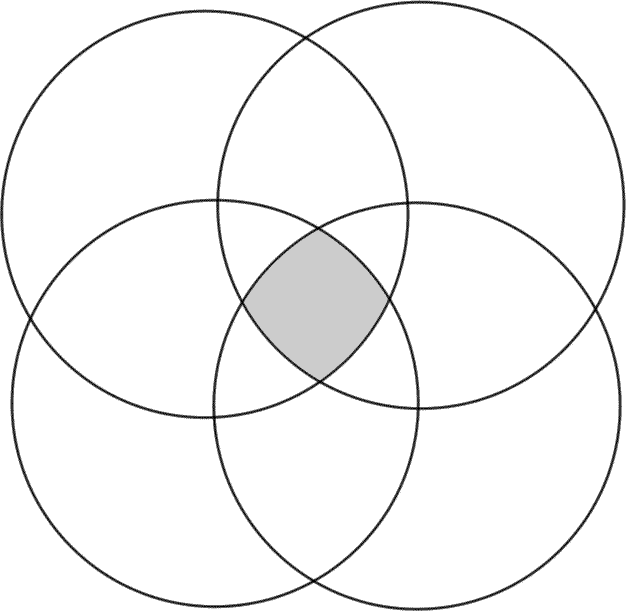
Now I want to estimate my position based on these distances and the access points position in order to find the error between the estimated position and the known position (9.5, 1.5). I want to find the intersection area (In order to estimate a position) between four circles where each access point is the center of one of the circles and the distance is the radius of the circle.

I want to find the grey area as shown in this image : http://www.biologycorner.com/resources/venn4.gif

pnuts
  • 58,317
  • 11
  • 87
  • 139
Joao Dias
  • 83
  • 10
  • 1
    Why have you tagged it with `matlab`? That doesn't look like Matlab code at all. – kkuilla Jul 28 '15 at 07:58
  • You are right. It is java code (My final target is Android). However I'm testing the calculations in MATLAB. I will put the similar MATLAB code instead. – Joao Dias Jul 28 '15 at 08:02
  • Your tags are inconsistent now. android tag doesn't apply any more. Also, you should really supply an [mcve](http://stackoverflow.com/help/mcve). In this instance, that means that you should add some sample data and the expected output of that data. This will significantly increase your chances of getting a useful answer. Your question is kind of arbitrary at the moment. It could be a maths, geometry or even a wireless networks question. – kkuilla Jul 28 '15 at 09:59
  • Where did that formula come from? – Oliver Charlesworth Jul 28 '15 at 23:24
  • https://en.wikipedia.org/wiki/Free-space_path_loss – Joao Dias Jul 28 '15 at 23:27
  • But you'd need to know the transmit power for that to work... – Oliver Charlesworth Jul 29 '15 at 07:37

4 Answers4

2

If you want an alternative way of estimating the location without estimating the intersection of circles you can use trilateration. It is a common technique in navigation (e.g. GPS) to estimate a position given a set of distance measurements.

Also, if you wanted the area because you also need an estimate of the uncertainty of the position I would recommend solving the trilateration problem using least squares which will easily give you an estimate of the parameters involved and an error propagation to yield an uncertainty of the location.

dpmcmlxxvi
  • 1,292
  • 1
  • 9
  • 13
  • What is trilateration if not the intersection of circles/spheres? – Oliver Charlesworth Jul 28 '15 at 23:23
  • They are related but not the same, the OP asked about finding the explicit area of the intersection, which is trickier to solve for (and not really needed) than just the point of intersection. – dpmcmlxxvi Jul 29 '15 at 00:28
1

I found an answear that solved perfectly the question. It is explained in detail in this link:

https://gis.stackexchange.com/questions/40660/trilateration-algorithm-for-n-amount-of-points

I also developed some MATLAB code for the problem. Here it goes:

Estimate distances from the Access Points:

function [ d_vect ] = distance( RSS )
    result = (27.55 - (20 * log10(2400)) + abs(RSS)) / 20;
    d_vect = power(10, result);
end

The trilateration function:

function [] = trilat( X, d, real1, real2 )
cla
circles(X(1), X(5), d(1), 'edgecolor', [0 0 0],'facecolor', 'none','linewidth',4); %AP1 - black
circles(X(2), X(6), d(2), 'edgecolor', [0 1 0],'facecolor', 'none','linewidth',4); %AP2 - green
circles(X(3), X(7), d(3), 'edgecolor', [0 1 1],'facecolor', 'none','linewidth',4); %AP3 - cyan 
circles(X(4), X(8), d(4), 'edgecolor', [1 1 0],'facecolor', 'none','linewidth',4); %AP4 - yellow
axis([0 10 0 10])
hold on
tbl = table(X, d);
d = d.^2;
weights = d.^(-1);
weights = transpose(weights);
beta0 = [5, 5];
modelfun = @(b,X)(abs(b(1)-X(:,1)).^2+abs(b(2)-X(:,2)).^2).^(1/2);
mdl = fitnlm(tbl,modelfun,beta0, 'Weights', weights);
b = mdl.Coefficients{1:2,{'Estimate'}}
scatter(b(1), b(2), 70, [0 0 1], 'filled')
scatter(real1, real2, 70, [1 0 0], 'filled')
hold off

end

Where,

X: matrix with APs coordinates

d: distance estimation vector

real1: real position x

real2: real position y

Joao Dias
  • 83
  • 10
1

If you have three sets of measurements with (x,y) coordinates of location and corresponding signal strength. such as:

m1 = (x1,y1,s1)
m2 = (x2,y2,s2)
m3 = (x3,y3,s3)

Then you can calculate distances between each of the point locations:

d12 = Sqrt((x1 - x2)^2 + (y1 - y2)^2)
d13 = Sqrt((x1 - x3)^2 + (y1 - y3)^2)
d23 = Sqrt((x2 - x3)^2 + (y2 - y3)^2)

Now consider that each signal strength measurement signifies an emitter for that signal, that comes from a location somewhere at a distance. That distance would be a radius from the location where the signal strength was measured, because one would not know at this point the direction from where the signal came from. Also, the weaker the signal... the larger the radius. In other words, the signal strength measurement would be inversely proportional to the radius. The smaller the signal strength the larger the radius, and vice versa. So, calculate the proportional, although not yet accurate, radius's of our three points:

r1 = 1/s1
r2 = 1/s2
r3 = 1/s3

So now, at each point pair, set apart by their distance we can calculate a constant (C) where the radius's from each location will just touch one another. For example, for the point pair 1 & 2:

Ca * r1 + Ca * r2 = d12

... solving for the constant Ca:

Ca = d12 / (r1 + r2)

... and we can do this for the other two pairs, as well.

Cb = d13 / (r1 + r3)

Cc = d23 / (r2 + r3)

All right... select the largest C constant, either Ca, Cb, or Cc. Then, use the parametric equation for a circle to find where the coordinates meet. I will explain.

The parametric equation for a circle is:

x = radius * Cos(theta)
y = radius * Sin(theta)

If Ca was the largest constant found, then you would compare points 1 & 2, such as:

Ca * r1 * Cos(theta1) == Ca * r2 * Cos(theta2) && 
Ca * r1 * Sin(theta1) == Ca * r2 * Sin(theta2)

... iterating theta1 and theta2 from 0 to 360 degrees, for both circles. You might write code like:

for theta1 in 0 ..< 360 {
    for theta2 in 0 ..< 360 {

        if( abs(Ca*r1*cos(theta1) - Ca*r2*cos(theta2)) < 0.01 && abs(Ca*r1*sin(theta1) - Ca*r2*sin(theta2)) < 0.01 ) {
            print("point is: (", Ca*r1*cos(theta1), Ca*r1*sin(theta1),")")
        }
    }
}

Depending on what your tolerance was for a match, you wouldn't have to do too many iterations around the circumferences of each signal radius to determine an estimate for the location of the signal source.

Stephen Rauch
  • 47,830
  • 31
  • 106
  • 135
Andrew
  • 174
  • 1
  • 6
0

So basically you need to intersect 4 circles. There can be many approaches to it, and there are two that will generate the exact intersection area.

First approach is to start with one circle, intersect it with the second circle, then intersect the resulting area with the third circle and so on. that is, on each step you know current intersection area, and you intersect it with a new circle. The intersection area will always be a region bounded by circle arcs, so to intersect it with a new circle you walk along the boundary of the area and check whether each bounding arc intersects with a new circle. If it does, then you leave only the part of the arc that lies inside a new circle, remember that you should continue with an arc from a new circle, and continue traversing the boundary until you find the next intersection.

Another approach that seems to result in a worse time complexity, but in your case of 4 circles this will not be important, is to find all the intersection points of two circles and choose only those points that are of interest for you, that is which lie inside all other circles. These points will be the corners of your area, and then it is rather easy to reconstruct the area. After googling a bit, I have even found a live demo of this approach.

Petr
  • 9,812
  • 1
  • 28
  • 52