2

When displaying two features, a polygon a (see geoJSON) and its minimum bounding rectangle b (see geoJSON), I get the following result when viewing from geojson.io:

image

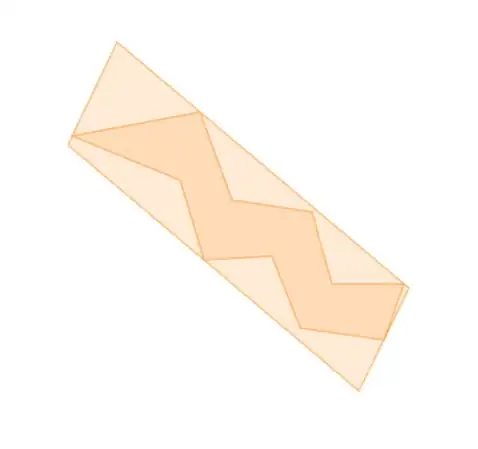
The minimum bounding rectangle around the polygon looks more like a parallelogram than a rectangle to me.

However, when I upload these same features to OpenLayers, the distortion is gone:

image

Is this a projection issue?

Kyle
  • 4,202
  • 1
  • 33
  • 41
  • Yes it looks like a projection issue... what projection are you using for the GeoJSON? are you using topojson/d3? – stephenspann Jun 23 '15 at 21:43
  • Yes indeed that appears to be due to different map projections for the base map and OpenLayers. If you make them same/similar, that distortion will disappear. – Emacs User Jun 23 '15 at 21:43

1 Answers1

1

The GeoJON shown on GitHub is projected using a Spherical Mercator projection. This done automatically is so it can overlay with other web-mapped data (e.g. I can see it is in Colorado).

The second image is a Cartesian projection of raw coordinate data, so it is not projected. So the bounding box preserves it's right angles.

Mike T
  • 41,085
  • 18
  • 152
  • 203