5

////OSMdroid centered on the markers////

I add markers, I need to map the maximum increases or decreases in such a way that all markers were visible

my code:

public class mapcode extends Activity {
    globalvar appState;
    int stats=0;
    private MapView mapView;
    private IMapController mapController;
    private SimpleLocationOverlay mMyLocationOverlay;
    private ScaleBarOverlay mScaleBarOverlay;  
    ItemizedIconOverlay<OverlayItem> currentLocationOverlay;
    DefaultResourceProxyImpl resourceProxy;
    
    protected void onCreate(Bundle savedInstanceState) {
        super.onCreate(savedInstanceState);
        requestWindowFeature(Window.FEATURE_INDETERMINATE_PROGRESS);
        setContentView(R.layout.map);
        
        appState = ((globalvar) getApplicationContext());


        mapView = (MapView) this.findViewById(R.id.mapview);  
        mapView.setTileSource(TileSourceFactory.MAPNIK);
      //  mapView.setBuiltInZoomControls(true); //кнопка ZOOM +-
        mapView.setMultiTouchControls(true);
        
        mapController = this.mapView.getController();
        mapController.setZoom(2);
        
        this.mMyLocationOverlay = new SimpleLocationOverlay(this);                          
        this.mapView.getOverlays().add(mMyLocationOverlay);
        
        this.mScaleBarOverlay = new ScaleBarOverlay(this);                          
        this.mapView.getOverlays().add(mScaleBarOverlay);
//      this.mapView
        
        /////////////////
        resourceProxy = new DefaultResourceProxyImpl(getApplicationContext());
        GeoPoint  currentLocation = new GeoPoint(55.860863,37.115046); 
        GeoPoint  currentLocation2 = new GeoPoint(63.557413,-156.102119); 
      
        
        OverlayItem myLocationOverlayItem = new OverlayItem("Here", "Current Position", currentLocation);
        Drawable myCurrentLocationMarker = this.getResources().getDrawable(R.drawable.a);
        myLocationOverlayItem.setMarker(myCurrentLocationMarker);
       // myLocationOverlayItem.setMarkerHotspot(HotspotPlace.CENTER); //no working/
        
        final ArrayList<OverlayItem> items = new ArrayList<OverlayItem>();
        items.add(myLocationOverlayItem);
        
        
        myLocationOverlayItem = new OverlayItem("Here", "Current Position", currentLocation2);
        myCurrentLocationMarker = this.getResources().getDrawable(R.drawable.a);
        myLocationOverlayItem.setMarker(myCurrentLocationMarker);

  //    myLocationOverlayItem.setMarkerHotspot(HotspotPlace.CENTER); // no working

        
        items.add(myLocationOverlayItem);


        currentLocationOverlay = new ItemizedIconOverlay<OverlayItem>(items,
                new ItemizedIconOverlay.OnItemGestureListener<OverlayItem>() {
                    public boolean onItemSingleTapUp(final int index, final OverlayItem item) {
                        return true;
                    }
                    public boolean onItemLongPress(final int index, final OverlayItem item) {
                        return true;
                    }
                }, resourceProxy);
        
        
        this.mapView.getOverlays().add(this.currentLocationOverlay);
}

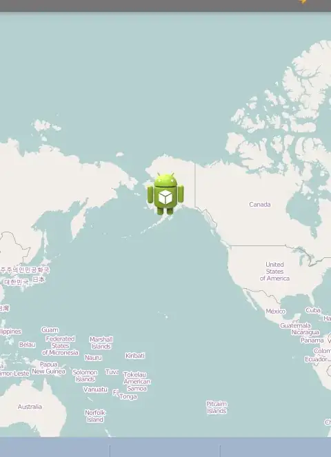
I added two markers, but only one is visible:

image with one marker

and I need to osmdroid is centered and immediately showed both marker

image with two marker

MaxiGui
  • 6,190
  • 4
  • 16
  • 33
SKULL
  • 885
  • 8
  • 15
  • 2
    You could use the `zoomToBoundingBox` method, but you would need to go through all of your markers to determine the top, left, bottom, and right coordinates. – saiarcot895 May 25 '14 at 00:22

2 Answers2

12

I think you want something like this:

int minLat = Integer.MAX_VALUE;
int maxLat = Integer.MIN_VALUE;
int minLong = Integer.MAX_VALUE;
int maxLong = Integer.MIN_VALUE;
ArrayList<OverlayItem> items = new ArrayList<OverlayItem>();
for (OverlayItem item : items) {
    GeoPoint point = item.getPoint();
    if (point.getLatitudeE6() < minLat)
        minLat = point.getLatitudeE6();
    if (point.getLatitudeE6() > maxLat)
        maxLat = point.getLatitudeE6();
    if (point.getLongitudeE6() < minLong)
        minLong = point.getLongitudeE6();
    if (point.getLongitudeE6() > maxLong)
        maxLong = point.getLongitudeE6();
}

BoundingBoxE6 boundingBox = new BoundingBoxE6(maxLat, maxLong, minLat, minLong);
mMapView.zoomToBoundingBox(boundingBox);
kurtzmarc
  • 3,110
  • 1
  • 24
  • 40
  • 1
    adding `mapController = mMapView.getController(); mapController.zoomToSpan(boundingBox.getLatitudeSpanE6(), boundingBox.getLongitudeSpanE6()); mapController.setCenter(boundingBox.getCenter());` after `mMapView.zoomToBoundingBox(boundingBox);` works perfectly fine for me. – Jei Jul 04 '17 at 07:09
  • 1
    Unable to see all markers even i set the BoundingBox boundingBox = new BoundingBox(north, west, south, east); boundingBox.getLongitudeSpanWithDateLine(); mMapView.zoomToBoundingBox(boundingBox, true); – Harish Oct 31 '19 at 07:12
0

You can calculate boundingBox by BoundingBox.fromGeoPoints(geoPoints)

fun zoomToBounds(points: List<LatLng>) {
    val geoPoints = points.map { GeoPoint(it.latitude, it.longitude) }
    val boundingBox = BoundingBox.fromGeoPoints(geoPoints)
    mapView.zoomToBoundingBox(boundingBox, true)
}

It is also possible to have some paddings by using zoomtoBoundingBox overloaded method and setting the pBorderSizeInPixels parameter

public double zoomToBoundingBox(
    final BoundingBox pBoundingBox, 
    final boolean pAnimated, 
    final int pBorderSizeInPixels, 
    final double pMaximumZoom, 
    final Long pAnimationSpeed
)
Ehsan Shadi
  • 609
  • 6
  • 17