According to Garmin | What is GPS?
A GPS receiver must be locked on to the signal of at least three satellites to calculate a 2D position (latitude and longitude) and track movement. With four or more satellites in view, the receiver can determine the user's 3D position (latitude, longitude and altitude).
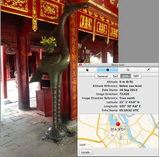
When exploring the GPS Exif from the attached image the altitude is 0m (0ft). This suggests to me that the 3D position lock was determined with four or more satellites although I'm reluctant to believe that the exact altitude is 0. Is it possible to rule out the possibility that the image was not taken with a 2D lock or even Wi-fi or cellular whereby the altitude value could perhaps default to 0?